


- [nb-NO]Object number[nb-NO]1974.110.1
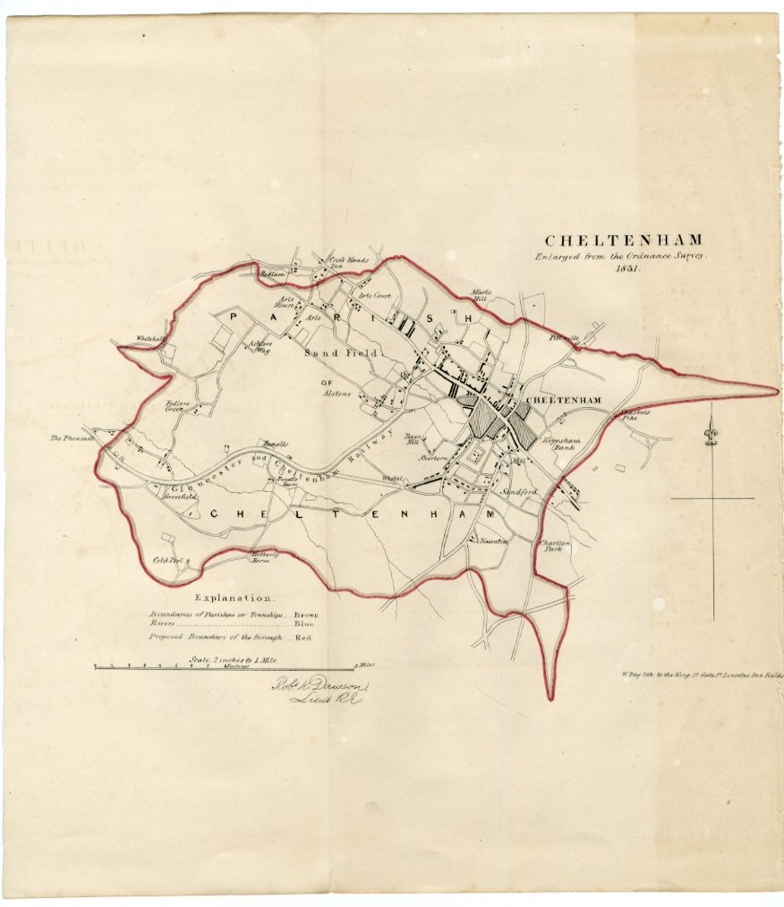
- [nb-NO]Title[nb-NO]A Town Plan of Cheltenham, 1831
- [nb-NO]Creator[nb-NO]W. Day (lithographer)
- A town plan of Cheltenham, showing the proposed boundary of the borough in red ink. Undated but based upon an Ordnance Survey map of 1831.
- [nb-NO]Date[nb-NO]1831
- [nb-NO]Object name[nb-NO]
- [nb-NO]Material[nb-NO]
- [nb-NO]Technique[nb-NO]
- [nb-NO]Dimensions[nb-NO]
- h: 346mm
- w: 306mm